Turbulence & Mountain Wave Module

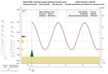
Example of a Mountain-Wave & Turbulence screen.

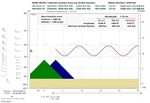
Example of a double mountain harmonic wave.

Example of a double mountain harmonic wave.

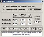
Example of a Mountain Options screen.
Features
- Analyzes atmospheric turbulence as an integrated function of lapse-rates and
wind shears. See video.
- This is the most complete method of determining atmospheric turbulence.
- Analyses wave turbulence for any atmosphere, regardless of mountainous terrain.
- Analyses mountain wave turbulence categories in the troposphere. Uses the Lyra-Scorer methodology to identify wave layers. Turbulence is a function of sounding stability, wind shear, and terrain. Mountain shapes are defined by 3 parameters:
- Mountain height // Mountain half-width at mid-elevation // Ridge (axis) orientation.
- Plots downrange lee waves on a configurable diagram.
- Plots both the predominate and secondary waves.
- Wave characteristics include: wavelength, amplitude, and vertical velocity.
- Provides downrange vertical velocities listings.
- Analyses harmonic (or resonant) waves resulting from double mountains.
- Individual and composite waves are graphically displayed.
- Single and double mountain parameter definitions can be appended to sounding data files.
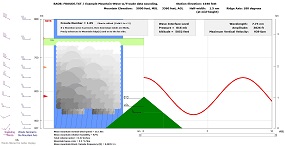
- Analyze Froude Number data to forecast enhanced mountain precipitation and downslope (Foehn and Chinook) winds.
- A unique RAOB.MTN parameter file allows cataloging of frequently used mountain parameters. See video.
- Mountain parameters are listed with respect to WMO numbers.
- This permits automatic retrieval of mountain parameters for WMO-identified sounding data.
- Both single and double mountain ridges can be listed in the RAOB.MTN file.
- If the optional Cross-Section module is purchased, then wave analyses can be displayed on the cross-section.


